What is GIS, and how does it relate to other technical geographical areas you’ve heard of like GPS, LiDAR, and Surveying? They are all related to location; finding and showing positions of objects on the Earth, as related to other objects. If you’re in a related industry that features the locations of things, such as AEC (architecture, engineering, and construction), you may have been exposed to tools or outputs from these areas but could use a primer on how they all compare. This post will describe them all and provide some of their differences and similarities.
GIS stands for Geographic Information Systems, and it’s more than just maps. It is the data, software, hardware, and people that all combine to work with and interpret location information, recording information in easy to understand formats for analysis to learn new things. GIS is used to map locations in different ways and apply those locations in analyses that are useful in almost any industry, from urban planning to agriculture. If you’re trying to apply this information to your work, some GIS data storage methods or file types include geodatabases, shapefiles, .kml files, and dozens of others.
GPS, or Global Positioning System, is an example of a GNSS, or Global Navigation Satellite System. These are satellite constellations aligned around the Earth for use in measurements. Examples of GNSS’ are GPS in the US or Galileo in Europe. These systems send coordinated signals from the satellites that GPS receivers can use to provide location. Examples of GPS receivers would include your Garmin watch, a car’s satellite navigation system, or a Trimble field collection unit (the yellow tripod devices and tablets you see used by survey crews or in AEC projects to manually obtain data). GPS units provide a way to collect data on the ground, anything from light poles to endangered species habitats. This data can be used in CADD (computer-aided drafting and design) systems for design and construction, or fed into a GIS for mapping and analysis. A common GPS file type is .gpx.
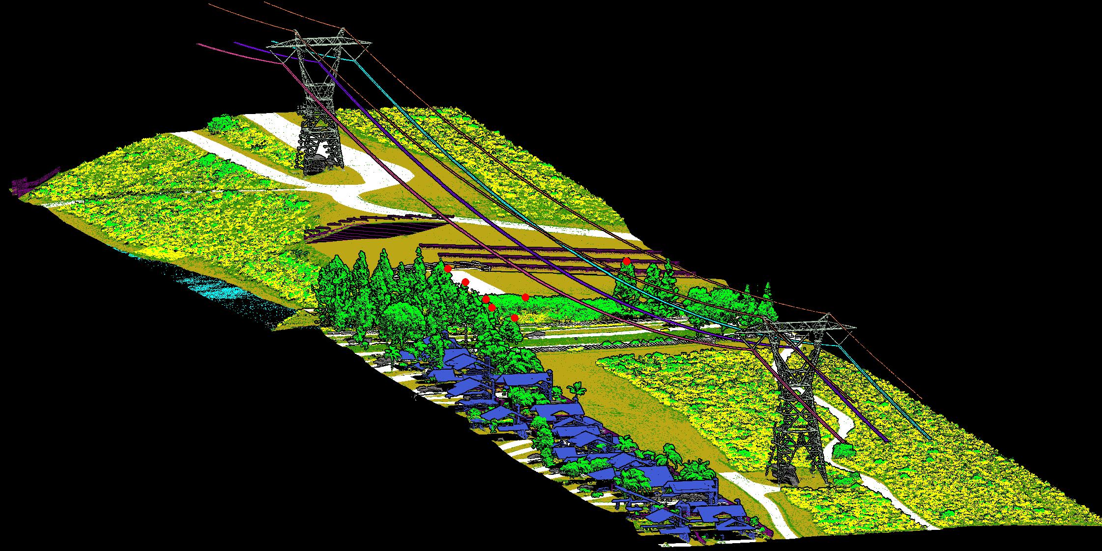
LiDAR stands for Light Detection and Ranging, another way to collect information about what’s on the ground. This is basically laser imaging from a stationary scanner, mobile scanner, satellite, airplane, or drone. Instead of collecting places, in the form of points from a GPS receiver, it collects what are referred to as clouds. The clouds are groups of thousands or millions of points. LiDAR cloud data can be shown in 3D to describe everything on the ground, from trees to buildings or even objects that are slightly underground or underwater. The .las file is a common output of a LiDAR system.
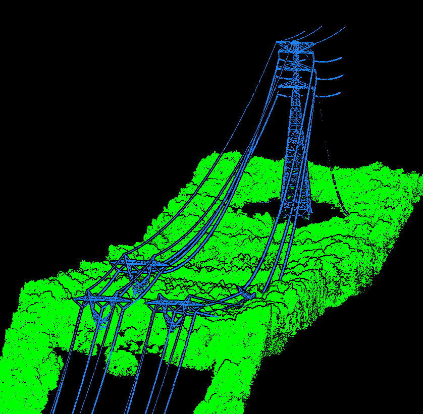
Example of LiDAR output
Surveying is the oldest of all these areas. It has been around as long as there has been the need to describe who owns what land and where the boundaries are. Surveying uses the locations and elevations of points on Earth, measuring distances and angles to provide extremely accurate data. The data is typically related to land parcels or locations of things that need to be built or placed somewhere, such as buildings or pipelines. Surveying can be 2D or 3D and optionally include the use of GPS or other technologies.
These areas and the tools they use are all related in that they are all within the geospatial realm; they are used to describe, map, and/or analyze parts of the Earth, whether natural or man-made. They all use specialized hardware and software tools that have been developed to assist, all of which require expertise to operate and manage. People or companies involved in the business of location, in any industry, could use one or all of these things in the course of their daily work.
They are also all different, of course, in their focus and use. GIS focuses on visualization (maps), analysis (learning from combining different layers), and manipulating data to move between applications. It can utilize data sourced from GPS, LiDAR, surveying, or many other methods as well. LiDAR is pure data collection, in a newer method that can give great insights. And, Surveying is more about measuring exact locations and distances with the highest precision possible, and collecting data for a specific purpose.
Hopefully this helps explain these various geospatial areas. GIS Surveyors is a firm that specializes in all of these disciplines, and is ready to help if you have any questions, or any need to get something done for your organization, or your customers. Federal, state, county or local governments, along with private companies large or small all have information and requirements that have to do with location, and GIS Surveyors can help.
About the Author:
John has worked in GIS for close to 20 years in sectors from federal to consulting to private enterprise. He has performed many GIS roles including Technician, Specialist, Web Developer, and Project Manager. He currently enjoys managing GIS projects in data collection, electric utilities, and more.
https://www.linkedin.com/in/johnshramek