Skip to content
GIS Surveyors
Your Geospatial Partner
GIS Surveyors
  • Home
  • Services
    • Land Survey
    • GIS
    • LiDAR
    • Utility Locating Services
  • Projects
  • About
    • Team
    • Safety
    • Press Releases
    • News
  • Careers
  • Contact Us
  • Home
  • Services
    • Land Survey
    • GIS
    • LiDAR
    • Utility Locating Services
  • Projects
  • About
    • Team
    • Safety
    • Press Releases
    • News
  • Careers
  • Contact Us

Category Archives: Industry News

The Importance of Precision

The Importance of Precision: Why Professional Utility Locating is Worth the Investment

GSI News, Industry NewsBy Sequent DevelopmentJune 20, 2023

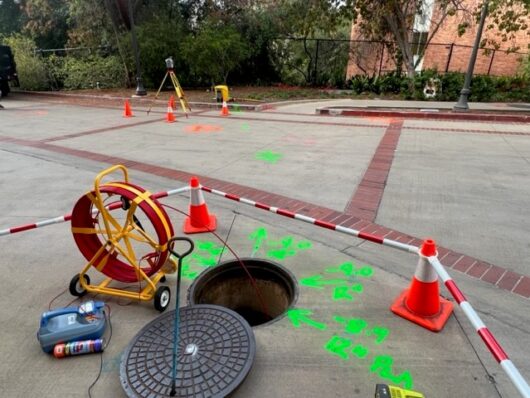
By: Brandon Ragone Are you a homeowner planning to dig or excavate on your property, or a contractor working on a jobsite? Before you grab your shovel or excavator and break ground, it’s important to remember that there may be more than meets the eye lurking beneath the surface. Hidden utility lines, pipes, and cables…

The Importance of Land Surveying

GSI News, Industry NewsBy Sequent DevelopmentMay 15, 2023

By: James Bocina, Jr. If you are looking for a piece of land to buy or develop, you need to know more than just its price and location. You need to know its features, its potential, and its challenges. You need a land survey. A land survey is a comprehensive analysis of a parcel of…

Paul Loska on Combat Vet Vision

Industry NewsBy Sequent DevelopmentAugust 16, 2021

Our CEO Paul Loska recently took part in a podcast on Combat Vet Vision. As a business owner and a U.S. Marine Corps Veteran, Paul is a troubleshooting expert that thrives when issued a problem to resolve, which is exactly why he’s known as one of Southern California’s best in his industry. Paul has 27…

ilmf 2020 Conference

International LiDAR Mapping Forum

GSI News, Industry NewsBy Sequent DevelopmentFebruary 26, 2020

GIS Surveyors, Inc. is excited to attend the International LiDAR Mapping Forum (ILMF) for the second year in a row. The ILMF is a technical conference and exhibition showcasing the latest airborne, terrestrial, and underwater LiDAR as well as emerging remote-sensing and data collection tools and technologies. Our team will be in attendance to learn…

Single Beam Echosounders

Inland Reservoir Surveys using Modular Single Beam Echosounders

Industry NewsBy Sequent DevelopmentFebruary 27, 2019

GSI used the CEE LINE echo sounder combined with a Trimble R10 RTK GNSS and Trimble TSC3 data collector to complete a bathymetric survey of Lake Eleanor. Located north of Los Angeles near Thousand Oaks at about 1000ft elevation the small lake survey was best conducted from a kayak. Using a trolling motor to minimize…

© 2021 - GIS Surveyors, Inc. - All Rights Reserved
Go to Top

We are using cookies to give you the best experience on our website.

You can find out more about which cookies we are using or switch them off in .

Skip to content
Open toolbar Accessibility Tools

Accessibility Tools

  • Increase TextIncrease Text
  • Decrease TextDecrease Text
  • GrayscaleGrayscale
  • High ContrastHigh Contrast
  • Negative ContrastNegative Contrast
  • Light BackgroundLight Background
  • Links UnderlineLinks Underline
  • Readable FontReadable Font
  • Reset Reset
GIS Surveyors
Powered by  GDPR Cookie Compliance
Privacy Overview

This website uses cookies so that we can provide you with the best user experience possible. Cookie information is stored in your browser and performs functions such as recognising you when you return to our website and helping our team to understand which sections of the website you find most interesting and useful.

Strictly Necessary Cookies

Strictly Necessary Cookie should be enabled at all times so that we can save your preferences for cookie settings.

If you disable this cookie, we will not be able to save your preferences. This means that every time you visit this website you will need to enable or disable cookies again.