Have you ever wondered about the best way to manage tasks on your GIS team? Your “team” started out with you handling all of it. You have juggled everything, from map requests and data management to selling GIS to internal teams and figuring out how to grow by using more sophisticated tools. Now you’re hiring, the team is growing, the company is expanding and the requests keep piling up. This post describes common methods to manage the work as you scale up in tandem with everything else.
From a high level, there are two main ways to organize project work, in most scenarios: Waterfall and Agile.
For Waterfall, picture an engineering company building a bridge: they need to design it, decide on everything that will be needed from beginning to end, and create a plan with all of the steps in order. The GIS work is built into the steps, such as making maps for different teams and stakeholders along the way or organizing the required geospatial data. To put it simply, if you deviate from the plan the bridge could be built incorrectly and fail. But you know the complete scope of the project, including costs and probable completion dates. You can use Waterfall for your GIS projects; it is straightforward and can be easier than Agile for estimating the cost for the customer at the end, which is sometimes critical.
For Agile, picture a software company, the most common application, and the reason it was created 25-ish years ago. In this case, the way to proceed is to create something basic to start with, or a Minimum Viable Product (MVP), and then get feedback from the customer for the rest of the way, alternating between adding features and continued feedback. This early feedback helps the product to be built in the best way possible.
Scrum is one popular flavor of Agile framework where there isn’t as much of a beginning to end plan, it’s all about “iterations”. You will have regular “sprints” of work, “standup” check-in meetings, and “backlog grooming” to keep breaking up and prioritizing the most valuable items or features to develop, as you go. Scrum can be applied to GIS work and is especially relevant when there is an application deliverable that accompanies the GIS output at the end of the project, such as a dashboard or a tool for customers to locate their assets on a map. Utilizing Scrum can help ensure you more fully meet customer needs and end up with a more usable product.
But there will be times when you’d really prefer Agile over Waterfall, for flexibility, but Scrum is too much for your tiny (but growing!) GIS team. Agile can be applied in forms other than the full, formal, complex Scrum framework. One alternative is Kanban, a lightweight version of Agile that can be used in a wide variety of projects or operations tasks.
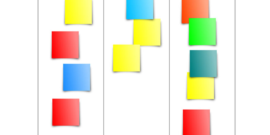
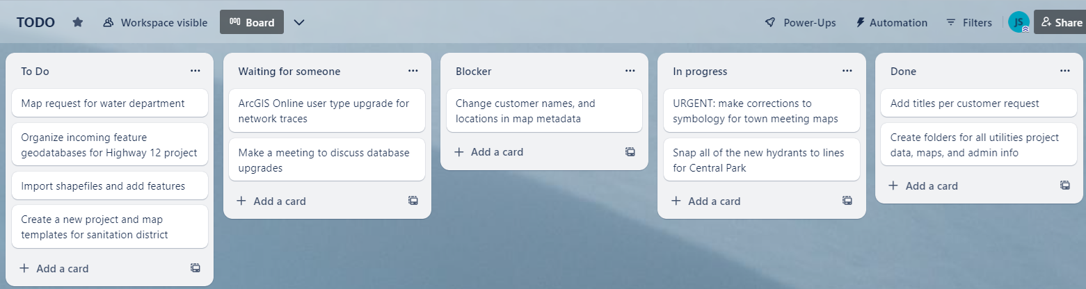
Kanban basically consists of work items that move from New, to In-Progress, then Done, visually from left to right. There can be more categories, but this is the essence; tracking what people are actively working on. Teams have been found to be most efficient by limiting WIP (Work In Progress). I like that Kanban focuses on GSD (Getting Stuff Done) –one of my favorite terms. It is ideal for smaller teams and companies, without resources or time to devote to the additional staff and rituals that Scrum requires. While Scrum needs to be a little more formalized, Kanban is simple and visual. Kanban teams prioritize the most urgent items, and anyone can see what work has or has not been started. To make an incredibly simple Kanban board, try this: put sticky notes on the wall in a vertical column describing all the tasks you need to get done. In another column to the right, put sticky notes for the tasks you are currently working on. As you complete items in the second column, move the sticky notes to the right so that you have a third column showing that tasks that you have completed. That’s it! From there you can add more descriptive columns, due dates, and more information on the sticky notes like due dates, work categories, priority levels, deliverables details, etc. Eventually you’ll probably want to use software, and there are many possibilities out there. You could end up with something that looks like this:
About the Author:
John is a certified SAFe ScrumMaster who has worked in GIS for close to 20 years in sectors such as: federal, consulting, and private enterprise. He has performed many GIS roles including Technician, Specialist, Web Developer, and Project Manager. He currently enjoys managing GIS projects in data collection, electric utilities, and more. https://www.linkedin.com/in/johnshramek